Keystone XL “re-route” through Nebraska still threatens Sandhills & Ogallala
TransCanada yesterday unveiled its proposed alternative routes—including a preferred alternative route—through Nebraska for its Keystone XL tar sands oil pipeline to the state’s Department of Environmental Quality.
The Keystone XL pipeline would pump up to 830,000 barrels per day of the world’s dirtiest oil from beneath Canada’s boreal forest through the United States’ heartland to oil refineries and international export ports on the Texas Gulf Coast. Along the way, it would endanger vital water sources, farmland central to sustaining rural economies, and our shared climate by igniting the continent’s biggest ‘carbon bomb,’ Alberta’s tar sands.
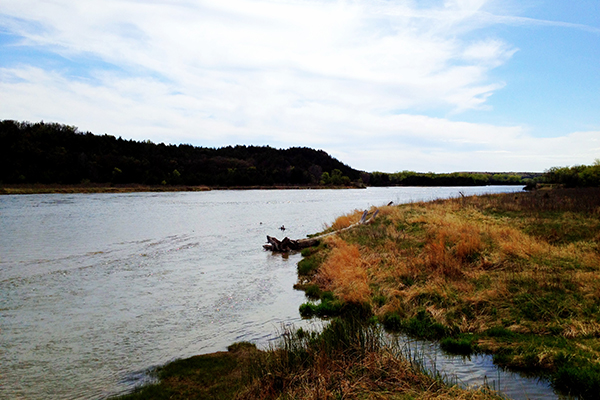
Unsurprisingly, the alternative routes still carry the same risks and the same threats. All of the alternative routes proposed by TransCanada would still cross the fragile Nebraska Sandhills, the largest dune formation in the United States. The grass-covered sand dunes are “still pretty much wild prairie, which is really hard to find in this country,” according to Mike George, Nebraska field supervisor for the US Fish & Wildlife Service. The environment is unique because the Ogallala Aquifer lies close to the surface in the Sandhills, and water bubbles up to form wetlands that provide an important habitat for nesting waterfowl.
What’s more, Keystone XL would bisect the Ogallala Aquifer, the largest aquifer on the continent, providing drinking water to two million people and supporting $20 billion in agriculture in the Midwest. A spill would be devastating to Nebraska’s farming industry, which contributed $15 billion to the state economy in 2009, worth 18 percent of Nebraska’s gross domestic product for that year.
We know that the dangers of this pipeline are many. Because tar sands oil is particularly toxic, compared to conventional crude oil, and because tar sands pipelines have an abysmal safety record, with a spill rate three times the national average for conventional oil in the Midwest, Keystone XL puts communities at risk of devastating oil spills and pollution to air and drinking water. Experts like University of Nebraska environmental engineering professor Dr. John Stansbury predict that it’s not a matter of ‘if’, but ‘when’ Keystone XL would spill—Dr. Stansbury places the risk at 91 such spills over 50 years.
Our friend and ally Ken Winston of the Nebraska Sierra Club aptly summed up how Nebraskan landowners and citizens are feeling about the newest development about alternative routes from TransCanada:
“Hell yes, this is still the Sand Hills.
TransCanada promised to move the Keystone XL pipeline route out of the Sand Hills. Sadly it appears that TransCanada has once again engaged in a game of deception, because their new route goes through areas that lifelong residents of the area like Karl Connell will tell you are definitely part of the Sand Hills. This latest development justifies the concerns that Nebraskans have about this pipeline and the way it is being forced on our state.”
Take Action: Sign the petition to tell President Obama that he must reject Keystone XL altogether.
Read Dr. John Stansbury’s Worst Case Spills Report here.
Photo of property in the Sandhills that would be crossed by the Keystone XL pipeline courtesy of Jane Kleeb, Bold Nebraska.
Related Posts
Ways to Support Our Work

Read Latest News
Stay informed and inspired. Read our latest press releases to see how we’re making a difference for the planet.

See Our Impact
See the real wins your support made possible. Read about the campaign wins we’ve fought for and won together.

Donate Today
Help power change. It takes support from environmental champions like you to build a more healthy and just world.